
1973 Map of Enigma
USGS Topo · Published 1976About this map
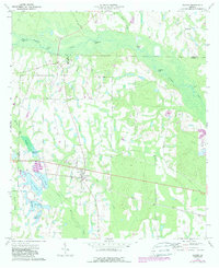
The town of Enigma serves as the focal point of this South Georgia landscape, situated at the junction of several county lines where Berrien, Tift, and Irwin counties meet. The community is oriented along the Seaboard Coast Line railroad, which cuts through the southern half of the quadrangle. Local life in the early 1970s was anchored by rural landmarks such as Turner Ch and Barnes Ch, while the surrounding terrain is defined by an intricate network of waterways and ponds. To the north and east, the Alapaha River meanders through the wetlands, fed by tributaries like Island Field Branch and Big Branch. The presence of several named lakes, including Lake Bobben, Lake Patrick, and McMillan Lake, alongside the Hardy Millpond, suggests a landscape deeply tied to water management and local recreation.
Find a feature on this map
27 named features on this map. Tap any name to fly to it.
Don’t see what you’re looking for? This feature index may not catch every label — zoom into the map to look around manually.
Map Details
Editions of this 1973 Enigma Map
2 editions found
Other maps of this area

1953 · Waycross
USGS Topo · 1:250,000

1958 · Waycross
USGS Topo · 1:250,000

1972 · Tenmile Bay
USGS Topo · 1:24,000

1972 · Ocilla East
USGS Topo · 1:24,000

1973 · Ocilla West
USGS Topo · 1:24,000

1973 · Sapps Lake
USGS Topo · 1:24,000

1973 · Waterloo
USGS Topo · 1:24,000

1973 · Lenox
USGS Topo · 1:24,000

1973 · Tifton East
USGS Topo · 1:24,000
1977 · Alapaha
USGS Topo · 1:24,000