
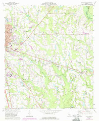
1973 Map of Tifton East
USGS Topo · Published 1976About this map
Tifton expands eastward in this early 1970s survey, showing a landscape defined by the convergence of several major transport routes including the Georgia Southern and Florida and the Seaboard Coast Line railroads. The area transition from urban development near Tift General Hospital to the rural outskirts is marked by established community anchors such as Mt Olive Ch, Wayside Ch, and Bailey Sch. Significant infrastructure for the era is prominent, including the Henry Tift Myers Airport and a series of industrial waste ponds.
Find a feature on this map
47 named features on this map. Tap any name to fly to it.
Don’t see what you’re looking for? This feature index may not catch every label — zoom into the map to look around manually.
Map Details
Editions of this 1973 Tifton East Map
2 editions found
Other maps of this area

1953 · Waycross
USGS Topo · 1:250,000

1958 · Waycross
USGS Topo · 1:250,000

1973 · Ocilla West
USGS Topo · 1:24,000

1973 · Sapps Lake
USGS Topo · 1:24,000

1973 · Waterloo
USGS Topo · 1:24,000

1973 · Enigma
USGS Topo · 1:24,000

1973 · Lenox
USGS Topo · 1:24,000

1973 · Chula
USGS Topo · 1:24,000

1973 · Tifton West
USGS Topo · 1:24,000

1973 · Omega
USGS Topo · 1:24,000