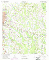
1973 Map of Tifton East
USGS Topo · Published 1988About this map
The agricultural and industrial transition of eastern Tifton is captured in this mid-1970s survey, updated with late-1980s data. The city’s eastward expansion is visible near Tift General Hospital and Henry Tift Myers Airport, while the surrounding Tift County landscape remains defined by its complex hydrology. The Little River and New River drain the terrain, which is dotted with numerous private ponds and natural basins like Bakers Pond and Marys Pond.
Find a feature on this map
42 named features on this map. Tap any name to fly to it.
Don’t see what you’re looking for? This feature index may not catch every label — zoom into the map to look around manually.
Map Details
Editions of this 1973 Tifton East Map
2 editions found
Other maps of this area

1953 · Waycross
USGS Topo · 1:250,000

1958 · Waycross
USGS Topo · 1:250,000

1973 · Ocilla West
USGS Topo · 1:24,000

1973 · Sapps Lake
USGS Topo · 1:24,000

1973 · Waterloo
USGS Topo · 1:24,000

1973 · Enigma
USGS Topo · 1:24,000

1973 · Lenox
USGS Topo · 1:24,000

1973 · Chula
USGS Topo · 1:24,000

1973 · Tifton East
USGS Topo · 1:24,000

1973 · Tifton West
USGS Topo · 1:24,000