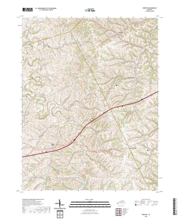
2022 Map of Sideview
USGS Topo · Published 2022About this map
The rolling Bluegrass country at the intersection of Bourbon, Clark, and Montgomery Counties is defined by the winding course of Stoner Creek and its many tributaries. This 2022 survey captures a landscape of long-established rural settlements, including Sideview in the north and Mount Zion to the west. The area's agricultural heritage is reflected in the dense network of historic pikes and roads, such as Paris Pike and White Turley Pike, which connect scattered homesteads and family cemeteries.
Find a feature on this map
65 named features on this map. Tap any name to fly to it.
Don’t see what you’re looking for? This feature index may not catch every label — zoom into the map to look around manually.
Map Details
Editions of this 2022 Sideview Map
This is the sole edition of this map. No revisions or reprints were ever made.
Other maps of this area

1892 · Richmond
USGS Topo · 1:125,000

1892 · Beattyville
USGS Topo · 1:125,000

1897 · Richmond
USGS Topo · 1:125,000

1950 · Levee
USGS Topo · 1:24,000

1952 · Sharpsburg
USGS Topo · 1:24,000

1952 · Paris East
USGS Topo · 1:24,000

1952 · Mount Sterling
USGS Topo · 1:24,000

1952 · Austerlitz
USGS Topo · 1:24,000

1952 · North Middletown
USGS Topo · 1:24,000

1952 · Levee
USGS Topo · 1:24,000