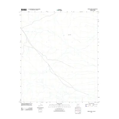
2011 Map of Sierra Arida
USGS Topo · Published 2011About this map
Sierra Arida dominates the arid landscape of this borderland region between Arizona and Sonora as documented in 2011. This sparsely populated terrain is defined by its drainages and isolated water sources, which are essential for survival in such an environment. Water management is evidenced by the inclusion of Sinita Tank and Tuseral Tank, points that likely serve as vital landmarks for those traversing the desert. The presence of these named tanks alongside a few unpaved roads and trails suggests a landscape primarily used for limited ranching, border monitoring, or seasonal passage rather than permanent settlement.
Find a feature on this map
3 named features on this map. Tap any name to fly to it.
Don’t see what you’re looking for? This feature index may not catch every label — zoom into the map to look around manually.
Map Details
Editions of this 2011 Sierra Arida Map
This is the sole edition of this map. No revisions or reprints were ever made.
Other maps of this area

1953 · Ajo
USGS Topo · 1:250,000

1957 · Ajo
USGS Topo · 1:250,000

1958 · Ajo
USGS Topo · 1:250,000

1962 · Ajo
USGS Topo · 1:250,000

1963 · Ajo
USGS Topo · 1:250,000

1965 · Cabeza Prieta Peak
USGS Topo · 1:62,500
1965 · Tule Mountains
USGS Topo · 1:62,500

1965 · Isla Pinta
USGS Topo · 1:62,500

1965 · Sierra Arida
USGS Topo · 1:62,500

1967 · Ajo
USGS Topo · 1:250,000