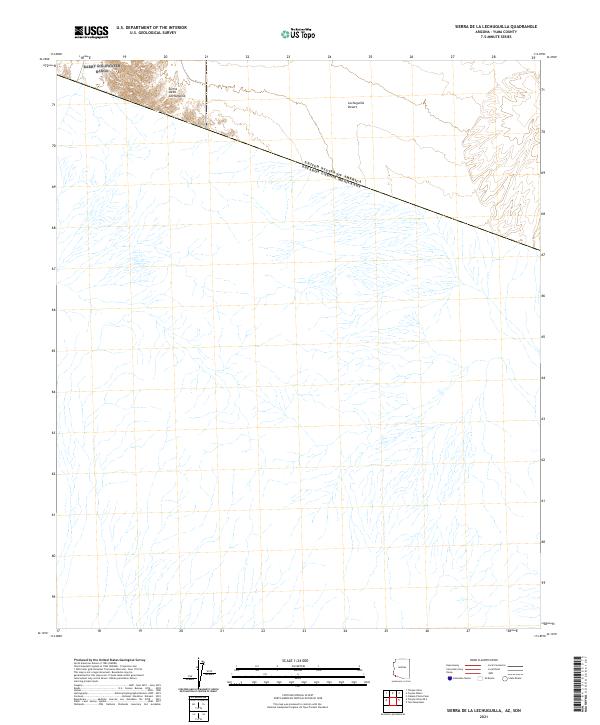
2021 Map of Sierra de la Lechuguilla
USGS Topo · Published 2021About this map
The United States of America Estados Unidos Mexicanos international boundary cuts diagonally across this remote desert landscape, marking the geopolitical divide between Arizona and Sonora. The terrain is dominated by the Sierra de la Lechuguilla, a mountain range that rises sharply in the northwest corner, while the vast Lechuguilla Desert floor extends across the central and eastern sections. This survey documents the arid topography of southern Yuma County in the modern era, showing the intricate drainage patterns of ephemeral washes that crisscross the sandy basin south of the border. Public Land Survey System grids, including t13s r16w and t14s r17w, provide the structural framework for the township and range divisions that define this borderland region.
Find a feature on this map
7 named features on this map. Tap any name to fly to it.
Don’t see what you’re looking for? This feature index may not catch every label — zoom into the map to look around manually.
Map Details
Editions of this 2021 Sierra de la Lechuguilla Map
This is the sole edition of this map. No revisions or reprints were ever made.
Other maps of this area

1942 · Yuma
USGS Topo · 1:250,000

1953 · Ajo
USGS Topo · 1:250,000

1954 · El Centro
USGS Topo · 1:250,000

1955 · El Centro
USGS Topo · 1:250,000

1957 · Ajo
USGS Topo · 1:250,000

1958 · Ajo
USGS Topo · 1:250,000

1958 · El Centro
USGS Topo · 1:250,000

1961 · El Centro
USGS Topo · 1:250,000

1962 · Ajo
USGS Topo · 1:250,000

1963 · Ajo
USGS Topo · 1:250,000