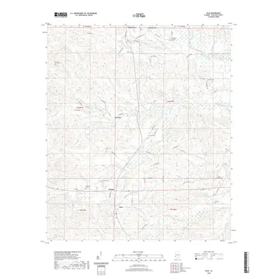
2020 Map of Silas
USGS Topo · Published 2020About this map
Gilbertown and Silas anchor this portion of southern Choctaw County, where the landscape is defined by a dense network of drainage creeks and small family cemeteries. The topography is etched by Souwilpa Cr, Thompson Cr, and the winding Turkey Creek, which create a complex system of ridges and valleys. Smaller settlements like Bolinger, Souwilpa, and Old Samuel are connected by a web of local routes including Co Rd 6 and Co Rd 14. For family historians, the area is notably dense with burial sites, ranging from the B F Smith Memorial Cem in the northwest to the Hall Cem in the southeast. This survey captures the rural character of the region, where numerous named branches like Doty House Br and Golden Horn Br flow into the larger creek systems that have historically dictated the placement of roads and homesteads.
Find a feature on this map
72 named features on this map. Tap any name to fly to it.
Don’t see what you’re looking for? This feature index may not catch every label — zoom into the map to look around manually.
Map Details
Editions of this 2020 Silas Map
This is the sole edition of this map. No revisions or reprints were ever made.
Other maps of this area

1953 · Hattiesburg
USGS Topo · 1:250,000

1958 · Hattiesburg
USGS Topo · 1:250,000

1971 · Ararat
USGS Topo · 1:24,000

1971 · Bladon Springs
USGS Topo · 1:24,000

1971 · Coffeeville Lock And Dam
USGS Topo · 1:24,000

1974 · Melvin
USGS Topo · 1:24,000

1974 · Millry North
USGS Topo · 1:24,000

1974 · Silas
USGS Topo · 1:24,000

1974 · Isney
USGS Topo · 1:24,000
1974 · Aquilla
USGS Topo · 1:24,000