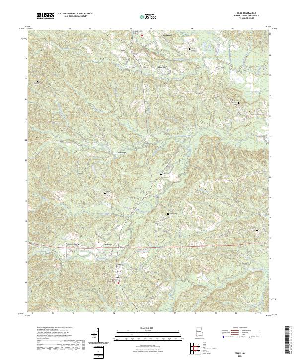
2024 Map of Silas
USGS Topo · Published 2024About this map
Silas and Gilbertown serve as the primary hubs in this corner of Choctaw County, connected by a network of rural routes and creek crossings. The landscape is defined by the winding course of Okatuppa Creek and its many tributaries, including Little Mill Creek and Souwilpa Creek. For genealogists, the map is particularly rich in family-named locations and burial grounds, such as Spring Bank Cem and Barrytown Cem. Smaller settlements like Souwilpa and Bolinger appear alongside more localized markers such as Old Samuel. The drainage patterns, including Wolf Creek and Turkey Creek, illustrate the complex hydrology that influenced early settlement and road placement throughout the township and range divisions. Local landmarks like the Gilbertown Church of God Cem and Harrison Cem provide concrete points of reference for those researching Choctaw County heritage.
Find a feature on this map
76 named features on this map. Tap any name to fly to it.
Don’t see what you’re looking for? This feature index may not catch every label — zoom into the map to look around manually.
Map Details
Editions of this 2024 Silas Map
This is the sole edition of this map. No revisions or reprints were ever made.
Other maps of this area

1953 · Hattiesburg
USGS Topo · 1:250,000

1958 · Hattiesburg
USGS Topo · 1:250,000

1971 · Ararat
USGS Topo · 1:24,000

1971 · Bladon Springs
USGS Topo · 1:24,000

1971 · Coffeeville Lock And Dam
USGS Topo · 1:24,000

1974 · Melvin
USGS Topo · 1:24,000

1974 · Millry North
USGS Topo · 1:24,000

1974 · Silas
USGS Topo · 1:24,000

1974 · Isney
USGS Topo · 1:24,000
1974 · Aquilla
USGS Topo · 1:24,000