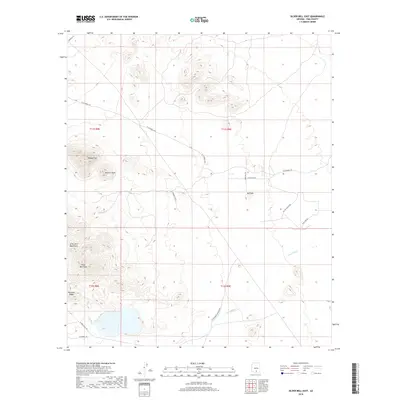
2018 Map of Silver Bell East
USGS Topo · Published 2018About this map
The Silver Bell Mountains dominate this Pima County landscape, anchored by the prominent Silver Bell Peak. The area is defined by its significant relief, where the steep terrain of Ragged Top and Wolcott Peak contrasts with the surrounding drainage systems. To the east, the seasonal Cocio Wash threads through the desert flats, while Portland Ridge and Red Hill mark secondary elevations. This region is a study in early 21st-century desert infrastructure, where long-established routes like W Silverbell Rd and N Waterman Mountain Rd provide access to the rugged interior. The map illustrates a network of named desert roads, including El Tiro Access Rd and W El Tiro Rd, which serve the high-desert terrain north of Avra Valley.
Find a feature on this map
21 named features on this map. Tap any name to fly to it.
Don’t see what you’re looking for? This feature index may not catch every label — zoom into the map to look around manually.
Map Details
Editions of this 2018 Silver Bell East Map
This is the sole edition of this map. No revisions or reprints were ever made.
Other maps of this area

1934 · Tucson Mountains
USGS Topo · 1:125,000

1934 · Silver Bell
USGS Topo · 1:125,000

1934 · Newman Peak
USGS Topo · 1:125,000

1947 · Red Rock
USGS Topo · 1:62,500

1947 · Eloy
USGS Topo · 1:62,500

1948 · Eloy
USGS Topo · 1:62,500

1956 · Tucson
USGS Topo · 1:250,000

1958 · Tucson
USGS Topo · 1:250,000

1959 · Tucson
USGS Topo · 1:250,000

1959 · Vaca Hills
USGS Topo · 1:62,500