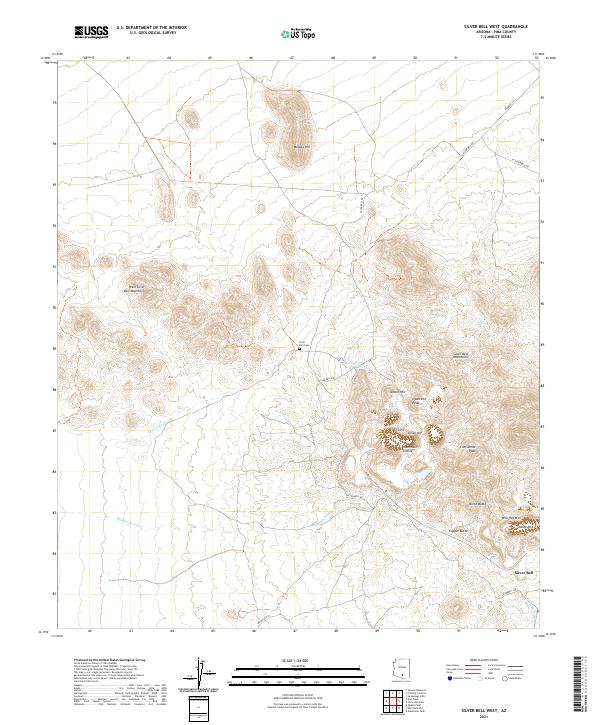
2021 Map of Silver Bell West
USGS Topo · Published 2021About this map
Mining operations dominate the landscape of the Silver Bell Mountains in this Pima County region. The settlement of Silver Bell sits at the base of these heights, where the topography is heavily shaped by industrial activity. Notable excavations such as the Oxide Pit and El Tiro Pit are clearly defined alongside historical mining landmarks like the Kurtz Shaft and Mammoth Incline. These features, clustered around Union Hill and Jesuit Hill, illustrate a legacy of mineral extraction that continues to define the local geography.
Find a feature on this map
33 named features on this map. Tap any name to fly to it.
Don’t see what you’re looking for? This feature index may not catch every label — zoom into the map to look around manually.
Map Details
Editions of this 2021 Silver Bell West Map
This is the sole edition of this map. No revisions or reprints were ever made.
Other maps of this area

1934 · Tucson Mountains
USGS Topo · 1:125,000

1934 · Silver Bell
USGS Topo · 1:125,000

1934 · Newman Peak
USGS Topo · 1:125,000

1947 · Red Rock
USGS Topo · 1:62,500

1947 · Eloy
USGS Topo · 1:62,500

1948 · Eloy
USGS Topo · 1:62,500

1956 · Tucson
USGS Topo · 1:250,000

1958 · Tucson
USGS Topo · 1:250,000

1959 · Tucson
USGS Topo · 1:250,000

1959 · Vaca Hills
USGS Topo · 1:62,500