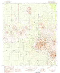
1989 Map of Silver Bell West
USGS Topo · Published 1989About this map
Extensive mining operations dominate this desert landscape, where the El Tiro Mine and Oxide Pit Mine reveal the industrial scale of late 20th-century extraction. Traces of the region's earlier heritage are visible at Silver Bell (Site) and Silverbell (Site), alongside the Silver Bell Cem and landmarks like the Kurtz Shaft and Mammoth Incline. The rugged interior is crossed by an Old Railroad Grade, which historically serviced these mineral deposits.
Find a feature on this map
36 named features on this map. Tap any name to fly to it.
Don’t see what you’re looking for? This feature index may not catch every label — zoom into the map to look around manually.
Map Details
Editions of this 1989 Silver Bell West Map
This is the sole edition of this map. No revisions or reprints were ever made.
Other maps of this area

1934 · Tucson Mountains
USGS Topo · 1:125,000

1934 · Silver Bell
USGS Topo · 1:125,000

1934 · Newman Peak
USGS Topo · 1:125,000

1947 · Red Rock
USGS Topo · 1:62,500

1947 · Eloy
USGS Topo · 1:62,500

1948 · Eloy
USGS Topo · 1:62,500

1956 · Tucson
USGS Topo · 1:250,000

1958 · Tucson
USGS Topo · 1:250,000

1959 · Tucson
USGS Topo · 1:250,000

1959 · Vaca Hills
USGS Topo · 1:62,500