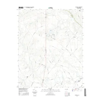
2016 Map of Silver Hill
USGS Topo · Published 2016About this map
Drowning Creek forms the natural boundary between Scotland and Hoke Counties, winding through a landscape defined by its many water bodies and family-named landmarks. The area around Wagram and Silver Hill shows a network of local roads such as Hill Creek Rd and N Turnpike Rd that connect rural residential clusters with historic burial grounds. Genealogists can identify several ancestral sites, including McNeill Cem and Wrights Cem, which are tucked away near the headwaters of Little Shoe Heel Cr. The presence of Monroe Mill Pond and Newtons Pond suggests a legacy of local water management and industry in this Sandhills region. Further north, the developed area of Deercroft sits near Dixie Pond, contrasting with the more dispersed settlements of Oak Hill and Spring Hill.
Find a feature on this map
75 named features on this map. Tap any name to fly to it.
Don’t see what you’re looking for? This feature index may not catch every label — zoom into the map to look around manually.
Map Details
Editions of this 2016 Silver Hill Map
This is the sole edition of this map. No revisions or reprints were ever made.
Other maps of this area

1942 · Troy
USGS Topo · 1:125,000

1942 · Rockingham
USGS Topo · 1:125,000

1948 · Southern Pines
USGS Topo · 1:62,500

1948 · Pinebluff
USGS Topo · 1:24,000

1948 · Mc Cain
USGS Topo · 1:24,000

1949 · Gibson
USGS Topo · 1:24,000

1949 · Wagram
USGS Topo · 1:24,000

1949 · Laurinburg
USGS Topo · 1:24,000

1949 · Silver Hill
USGS Topo · 1:24,000

1949 · Hoffman
USGS Topo · 1:24,000