
1949 Map of Hoffman
USGS Topo · Published 1953About this map
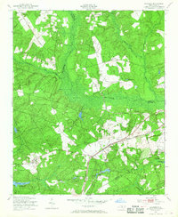
The town of Hoffman serves as a central hub on this 1949 survey, situated along the corridor of the Seaboard Air Line railroad. This region of the North Carolina Sand Hills is characterized by its transition from agricultural lands to state and federal managed areas, including the Camp Mackall Military Reservation on the eastern boundary. The presence of the McKinney Lake Fish Hatchery and the adjacent Game Farm highlight a landscape deeply integrated with early 20th-century conservation and state-run wildlife management efforts.
Find a feature on this map
47 named features on this map. Tap any name to fly to it.
Don’t see what you’re looking for? This feature index may not catch every label — zoom into the map to look around manually.
Map Details
Editions of this 1949 Hoffman Map
3 editions found
Other maps of this area

1942 · Troy
USGS Topo · 1:125,000

1942 · Rockingham
USGS Topo · 1:125,000

1948 · Southern Pines
USGS Topo · 1:62,500

1948 · Pinebluff
USGS Topo · 1:24,000

1949 · Millstone Lake
USGS Topo · 1:24,000

1949 · Silver Hill
USGS Topo · 1:24,000

1949 · West End
USGS Topo · 1:24,000

1949 · Marston
USGS Topo · 1:24,000

1949 · Hamlet
USGS Topo · 1:24,000

1949 · Hamlet
USGS Topo · 1:62,500