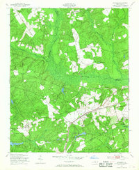
1949 Map of Hoffman
USGS Topo · Published 1968About this map
Hoffman serves as the primary settlement hub in this 1949 survey, situated along the Seaboard Air Line railroad. The landscape is defined by the Sand Hills and the winding course of Drowning Creek, which marks the boundary between Moore and Richmond counties. Notable institutional landmarks include the Morrison Training Sch and the extensive Camp Mackall Military Reservation in the southeast corner.
Find a feature on this map
47 named features on this map. Tap any name to fly to it.
Don’t see what you’re looking for? This feature index may not catch every label — zoom into the map to look around manually.
Map Details
Editions of this 1949 Hoffman Map
3 editions found
Other maps of this area

1942 · Troy
USGS Topo · 1:125,000

1942 · Rockingham
USGS Topo · 1:125,000

1948 · Southern Pines
USGS Topo · 1:62,500

1948 · Pinebluff
USGS Topo · 1:24,000

1949 · Millstone Lake
USGS Topo · 1:24,000

1949 · Silver Hill
USGS Topo · 1:24,000

1949 · West End
USGS Topo · 1:24,000

1949 · Hoffman
USGS Topo · 1:24,000

1949 · Marston
USGS Topo · 1:24,000

1949 · Hamlet
USGS Topo · 1:24,000