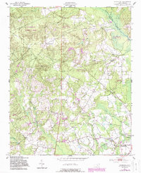
1949 Map of Silver Hill
USGS Topo · Published 1983About this map
Sandhills Game Land dominates the northern and western reaches of this Scotland County landscape, where the sandy terrain transitions into the well-watered agricultural lands surrounding Wagram. Originally mapped in the late 1940s, this survey documents a rural society structured around local gathering places like the Nashville Sch and Shaw School, alongside numerous community churches including St Peters Ch and Naomi Ch. The local economy of the mid-20th century is evident in the presence of the Monroe Mill Pond and the operations of the Laurinburg and Southern railroad line. Family history and local heritage are well-preserved through numerous burial grounds such as Oak Hill Cem and McNeill Cem. Waterways like Drowning Creek and Shoe Heel Creek define the drainage patterns of the region, influenced by the distinct topography of the North Carolina Sandhills.
Find a feature on this map
30 named features on this map. Tap any name to fly to it.
Don’t see what you’re looking for? This feature index may not catch every label — zoom into the map to look around manually.
Map Details
Editions of this 1949 Silver Hill Map
3 editions found
Other maps of this area

1942 · Troy
USGS Topo · 1:125,000

1942 · Rockingham
USGS Topo · 1:125,000

1948 · Southern Pines
USGS Topo · 1:62,500

1948 · Pinebluff
USGS Topo · 1:24,000

1948 · Mc Cain
USGS Topo · 1:24,000

1949 · Gibson
USGS Topo · 1:24,000

1949 · Wagram
USGS Topo · 1:24,000

1949 · Laurinburg
USGS Topo · 1:24,000

1949 · Silver Hill
USGS Topo · 1:24,000

1949 · Hoffman
USGS Topo · 1:24,000