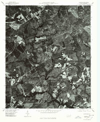
1976 Map of Marston
USGS Topo · Published 1978About this map
Marston and Cognac serve as the primary nodes of settlement in this mid-1970s orthophotoquad, which uses aerial photography to detail the landscape of Scotland County. The imagery reveals a complex arrangement of dark, forested wetlands and cleared agricultural parcels characteristic of the Sandhills region. Large bodies of water like Gum Swamp Lake and Crawford Lake dominate the central and lower portions of the sheet, surrounded by dense vegetation. This format provides a literal view of land use, showing the exact boundaries of timber stands and farm fields as they appeared when the photographs were captured in early 1976. The straight lines of rural roads and potential rail corridors cut through the irregular patterns of the swampy terrain, linking these small communities to the surrounding region.
Find a feature on this map
4 named features on this map. Tap any name to fly to it.
Don’t see what you’re looking for? This feature index may not catch every label — zoom into the map to look around manually.
Map Details
Editions of this 1976 Marston Map
This is the sole edition of this map. No revisions or reprints were ever made.
Other maps of this area

1942 · Troy
USGS Topo · 1:125,000

1942 · Rockingham
USGS Topo · 1:125,000

1948 · Southern Pines
USGS Topo · 1:62,500

1948 · Pinebluff
USGS Topo · 1:24,000

1949 · Gibson
USGS Topo · 1:24,000

1949 · Millstone Lake
USGS Topo · 1:24,000

1949 · Ghio
USGS Topo · 1:24,000

1949 · Laurinburg
USGS Topo · 1:24,000

1949 · Silver Hill
USGS Topo · 1:24,000

1949 · Hoffman
USGS Topo · 1:24,000