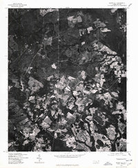
1976 Map of Silver Hill
USGS Topo · Published 1978About this map
Silver Hill and its surrounding countryside in Scotland County appear in this 1976 orthophotoquad, which uses rectified aerial imagery to reveal the precise textures of the mid-1970s landscape. Unlike traditional line maps, this photographic survey, produced by the Geological Survey and the Soil Conservation Service, documents the exact patterns of agricultural clearing and dense woodland coverage near Oak Hill and Spring Hill. The central corridor is dominated by the path of Highway 15 501, which serves as the primary artery through this patchwork of timber tracts and family farms. Local historians can trace the specific land-use boundaries and rural development that defined these small communities during the Bicentennial era, providing a raw visual record of the region's topography before more recent reforestation and modern infrastructure changes.
Find a feature on this map
4 named features on this map. Tap any name to fly to it.
Don’t see what you’re looking for? This feature index may not catch every label — zoom into the map to look around manually.
Map Details
Editions of this 1976 Silver Hill Map
This is the sole edition of this map. No revisions or reprints were ever made.
Other maps of this area

1942 · Troy
USGS Topo · 1:125,000

1942 · Rockingham
USGS Topo · 1:125,000

1948 · Southern Pines
USGS Topo · 1:62,500

1948 · Pinebluff
USGS Topo · 1:24,000

1948 · Mc Cain
USGS Topo · 1:24,000

1949 · Gibson
USGS Topo · 1:24,000

1949 · Wagram
USGS Topo · 1:24,000

1949 · Laurinburg
USGS Topo · 1:24,000

1949 · Silver Hill
USGS Topo · 1:24,000

1949 · Hoffman
USGS Topo · 1:24,000