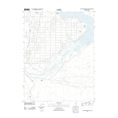
2011 Map of Silver Springs South
USGS Topo · Published 2011About this map
The Carson River winds through this Nevada landscape, feeding into the extensive Lahontan Reservoir along the eastern edge of the quadrangle. This 2011 survey illustrates the residential growth of Silver Springs, showing a dense grid of streets such as Revere St and Hale St that extend toward the shoreline. Further south, the map identifies Davis Station and the distinctive Big Bend of the Carson, where the river makes a sharp northern turn toward the reservoir. The topography reflects the arid basin character of Churchill Valley, transitioning from the structured suburban layout of Silver Springs Beach to the more open terrain along the riverbanks. Local history and genealogy researchers will find the specific street-level detail and the relationship between the river and the developing desert communities particularly useful.
Find a feature on this map
91 named features on this map. Tap any name to fly to it.
Don’t see what you’re looking for? This feature index may not catch every label — zoom into the map to look around manually.
Map Details
Editions of this 2011 Silver Springs South Map
This is the sole edition of this map. No revisions or reprints were ever made.
Other maps of this area

1891 · Wabuska
USGS Topo · 1:125,000

1894 · Wabuska
USGS Topo · 1:125,000

1957 · Como
USGS Topo · 1:62,500

1957 · Wabuska
USGS Topo · 1:62,500

1957 · Churchill Butte
USGS Topo · 1:62,500

1957 · Silver Springs
USGS Topo · 1:62,500

1957 · Reno
USGS Topo · 1:250,000

1959 · Reno
USGS Topo · 1:250,000

1960 · Reno
USGS Topo · 1:250,000

1979 · Carson City
USGS Topo · 1:100,000