
1957 Map of Churchill Butte
USGS Topo · Published 1959About this map
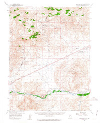
The Carson River flows through the southern reaches of this landscape, flanked by the remnants of Nevada's military and mining history in the late 1950s. The site of Fort Churchill and the surrounding Fort Churchill State Park mark a significant historical corridor where the Southern Pacific railroad parallels the river. Agricultural development is evident through a network of irrigation works including the Koch Ditch and Buckland Ditch, supporting small settlements like Churchill and the vanished Clifton.
Find a feature on this map
50 named features on this map. Tap any name to fly to it.
Don’t see what you’re looking for? This feature index may not catch every label — zoom into the map to look around manually.
Map Details
Editions of this 1957 Churchill Butte Map
3 editions found
Other maps of this area

1890 · Wadsworth
USGS Topo · 1:125,000

1891 · Carson
USGS Topo · 1:125,000

1891 · Wabuska
USGS Topo · 1:125,000

1891 · Reno
USGS Topo · 1:125,000

1892 · Wadsworth
USGS Topo · 1:125,000

1893 · Carson
USGS Topo · 1:125,000

1893 · Reno
USGS Topo · 1:125,000

1894 · Wadsworth
USGS Topo · 1:125,000

1894 · Wabuska
USGS Topo · 1:125,000

1950 · Virginia City
USGS Topo · 1:62,500