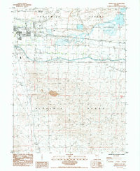
1985 Map of Fernley East
USGS Topo · Published 1985About this map
Fernley sits at the western edge of the formidable Forty Mile Desert, serving as a critical hub where irrigation and transport infrastructure meet the arid Basin and Range. This mid-1980s survey illustrates a landscape defined by water management and transit, featuring the Truckee River (Route) and the Truckee Canal alongside the Southern Pacific tracks. The convergence of the historic Emigrant Trail with modern infrastructure like the Gravel Landing Strip and extensive Pipeline networks reveals the layers of movement through this corridor.
Find a feature on this map
21 named features on this map. Tap any name to fly to it.
Don’t see what you’re looking for? This feature index may not catch every label — zoom into the map to look around manually.
Map Details
Editions of this 1985 Fernley East Map
2 editions found
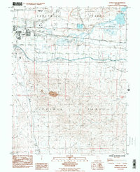
Other maps of this area

1890 · Wadsworth
USGS Topo · 1:125,000

1891 · Wabuska
USGS Topo · 1:125,000

1892 · Wadsworth
USGS Topo · 1:125,000

1894 · Wadsworth
USGS Topo · 1:125,000

1894 · Wabuska
USGS Topo · 1:125,000

1957 · Churchill Butte
USGS Topo · 1:62,500

1957 · Two Tips
USGS Topo · 1:62,500

1957 · Wadsworth
USGS Topo · 1:62,500

1957 · Silver Springs
USGS Topo · 1:62,500

1957 · Reno
USGS Topo · 1:250,000