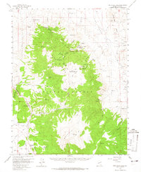
1958 Map of Pine Grove Hills
USGS Topo · Published 1965About this map
Pine Grove and Rockland appear as the primary centers of human activity in this mid-century survey of the Pine Grove Hills. The landscape is dominated by the Toiyabe National Forest, where a network of pack trails and jeep trails connects numerous mining operations. The high-altitude terrain is marked by significant peaks including Bald Mountain and Lobdell Summit, while the presence of a Cemetery near the Wilson Mines provides a tangible link to the area's early mining communities.
Find a feature on this map
58 named features on this map. Tap any name to fly to it.
Don’t see what you’re looking for? This feature index may not catch every label — zoom into the map to look around manually.
Map Details
Editions of this 1958 Pine Grove Hills Map
2 editions found

Other maps of this area

1891 · Wellington
USGS Topo · 1:125,000

1893 · Wellington
USGS Topo · 1:125,000

1909 · Hawthorne
USGS Topo · 1:250,000

1909 · Bridgeport
USGS Topo · 1:125,000

1911 · Bridgeport
USGS Topo · 1:125,000

1911 · Hawthorne
USGS Topo · 1:250,000

1915 · Hawthorne
USGS Topo · 1:250,000

1920 · Bridgeport
USGS Topo · 1:125,000

1948 · Walker Lake
USGS Topo · 1:250,000

1956 · Mt. Grant
USGS Topo · 1:62,500