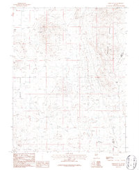
1986 Map of Yerington NE
USGS Topo · Published 1987About this map
Industrial mineral exploration and high-desert terrain define this mid-1980s landscape east of Yerington. The Wassuk Range dominates the eastern portion of the map, marked by a dense concentration of prospects, adits, and named mining sites like the Blue Jay Mine and Copper Ridge Mine. These workings indicate the extensive geological surveying and extraction efforts that shaped the local economy and land use during this era.
Find a feature on this map
30 named features on this map. Tap any name to fly to it.
Don’t see what you’re looking for? This feature index may not catch every label — zoom into the map to look around manually.
Map Details
Editions of this 1986 Yerington NE Map
This is the sole edition of this map. No revisions or reprints were ever made.
Other maps of this area

1891 · Wabuska
USGS Topo · 1:125,000

1891 · Wellington
USGS Topo · 1:125,000

1893 · Wellington
USGS Topo · 1:125,000

1894 · Wabuska
USGS Topo · 1:125,000

1908 · Carson Sink
USGS Topo · 1:250,000

1909 · Hawthorne
USGS Topo · 1:250,000

1910 · Carson Sink
USGS Topo · 1:250,000

1911 · Hawthorne
USGS Topo · 1:250,000

1915 · Hawthorne
USGS Topo · 1:250,000

1948 · Walker Lake
USGS Topo · 1:250,000