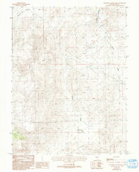
1987 Map of Churchill Canyon Well
USGS Topo · Published 1993About this map
Churchill Canyon and the eastern edge of the Pine Nut Mountains define this high-desert terrain in Lyon and Nevada counties. In this 1980s landscape, water management is the primary human imprint, evidenced by the central Churchill Canyon Well, a Spring near the Churchill Narrows, and several livestock-supporting Guzzler features. The resource-driven nature of the region is further marked by a Mine Shaft and various Prospects located between the canyon floors and the ridgelines. To the east, the terrain levels out into the Adrian Valley, where a large Dry Lake bed sits south of a utility corridor marked by a Trans Line and Pipeline. This survey captures a moment of ranching and mineral exploration in a workspace where Corrals and wells were the most significant landmarks.
Find a feature on this map
17 named features on this map. Tap any name to fly to it.
Don’t see what you’re looking for? This feature index may not catch every label — zoom into the map to look around manually.
Map Details
Editions of this 1987 Churchill Canyon Well Map
2 editions found
Other maps of this area

1891 · Wabuska
USGS Topo · 1:125,000

1894 · Wabuska
USGS Topo · 1:125,000

1957 · Como
USGS Topo · 1:62,500

1957 · Wabuska
USGS Topo · 1:62,500

1957 · Churchill Butte
USGS Topo · 1:62,500

1957 · Silver Springs
USGS Topo · 1:62,500

1957 · Reno
USGS Topo · 1:250,000

1959 · Reno
USGS Topo · 1:250,000

1960 · Reno
USGS Topo · 1:250,000

1979 · Carson City
USGS Topo · 1:100,000