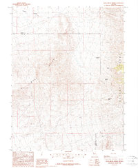
1988 Map of Buck Brush Spring
USGS Topo · Published 1988About this map
The high desert terrain of the Gray Hills and the Wassuk Range dominates this late-twentieth-century survey along the border of Lyon and Mineral counties. The landscape is defined by its water sources, with several named springs such as Buck Brush Spring, Summit Spring, and Abraham Spring providing critical points of reference in an otherwise arid environment. Evidence of mineral exploration is scattered across the slopes, indicated by numerous prospects, a group of prospects in the northeast, and an Adit near the center of the sheet. The presence of VABM Marble Sta 4 and the drainage of Pumpkin Hollow further detail this sparsely settled region, where the economy was primarily driven by small-scale mining and ranching infrastructure like the Water Tank Spring.
Find a feature on this map
13 named features on this map. Tap any name to fly to it.
Don’t see what you’re looking for? This feature index may not catch every label — zoom into the map to look around manually.
Map Details
Editions of this 1988 Buck Brush Spring Map
This is the sole edition of this map. No revisions or reprints were ever made.
Other maps of this area

1891 · Wellington
USGS Topo · 1:125,000

1893 · Wellington
USGS Topo · 1:125,000

1909 · Hawthorne
USGS Topo · 1:250,000

1911 · Hawthorne
USGS Topo · 1:250,000

1915 · Hawthorne
USGS Topo · 1:250,000

1948 · Walker Lake
USGS Topo · 1:250,000

1956 · Mt. Grant
USGS Topo · 1:62,500

1957 · Walker Lake
USGS Topo · 1:250,000

1957 · Yerington
USGS Topo · 1:62,500

1958 · Pine Grove Hills
USGS Topo · 1:62,500