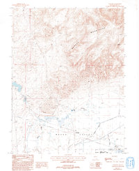
1987 Map of Wabuska
USGS Topo · Published 1993About this map
Mason Valley and the Desert Mountains converge in this late 20th-century survey of Lyon County. The landscape is defined by the hydrologic engineering required to manage the arid environment, including the Spragg Alcorn Bewley Ditch, a Wabuska Drain, and numerous Alkali Flats. The settlement of Wabuska sits at the nexus of several vital infrastructure lines, including a Pipeline and an Old Railroad Grade, reflecting the area's history as a transportation and utility corridor. Significant geothermal activity is noted at Wabuska Hot Springs, while resource extraction is evident through several scattered Prospects and Gravel Pits north of Conklin. Natural features like the Perazzo slough and the Mason Valley Wildlife Management Area illustrate the intersection of agricultural drainage and habitat conservation.
Find a feature on this map
28 named features on this map. Tap any name to fly to it.
Don’t see what you’re looking for? This feature index may not catch every label — zoom into the map to look around manually.
Map Details
Editions of this 1987 Wabuska Map
2 editions found
Other maps of this area

1891 · Wabuska
USGS Topo · 1:125,000

1894 · Wabuska
USGS Topo · 1:125,000

1957 · Como
USGS Topo · 1:62,500

1957 · Wabuska
USGS Topo · 1:62,500

1957 · Churchill Butte
USGS Topo · 1:62,500

1957 · Silver Springs
USGS Topo · 1:62,500

1957 · Reno
USGS Topo · 1:250,000

1959 · Reno
USGS Topo · 1:250,000

1960 · Reno
USGS Topo · 1:250,000

1979 · Carson City
USGS Topo · 1:100,000