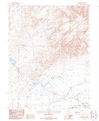
1987 Map of Wabuska
USGS Topo · Published 1987About this map
Wabuska sits at the intersection of early Nevada transport and industry, where the Southern Pacific railroad line cuts through the arid basin. To the south, the Mason Valley opens into the Mason Valley Wildlife Management Area, a complex of water management features including the Perazzo Slough, numerous canals, and designated dikes. The landscape is defined by the sharp transition from the wetland-adjacent valley floor to the high peaks of the Desert Mountains, anchored by Cleaver Peak in the northeast.
Find a feature on this map
23 named features on this map. Tap any name to fly to it.
Don’t see what you’re looking for? This feature index may not catch every label — zoom into the map to look around manually.
Map Details
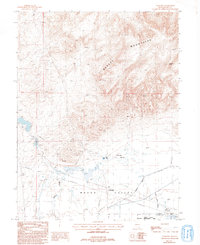
Editions of this 1987 Wabuska Map
2 editions found
Other maps of this area

1891 · Wabuska
USGS Topo · 1:125,000

1894 · Wabuska
USGS Topo · 1:125,000

1957 · Como
USGS Topo · 1:62,500

1957 · Wabuska
USGS Topo · 1:62,500

1957 · Churchill Butte
USGS Topo · 1:62,500

1957 · Silver Springs
USGS Topo · 1:62,500

1957 · Reno
USGS Topo · 1:250,000

1959 · Reno
USGS Topo · 1:250,000

1960 · Reno
USGS Topo · 1:250,000

1979 · Carson City
USGS Topo · 1:100,000