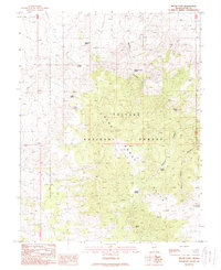
1988 Map of Mount Etna
USGS Topo · Published 1989About this map
Pine Grove Hills define this high-altitude landscape in Lyon County, where the Toiyabe National Forest covers much of the high desert terrain. The area's history of mineral exploration is visible through the presence of the Cowboy Mine and various scattered Prospects, suggesting a legacy of small-scale mining operations that once sought fortune in these remote peaks. Steep drainage systems like Mickey Canyon and Scotts Canyon cut through the topography, leading up toward prominent landmarks like Mount Etna.
Find a feature on this map
19 named features on this map. Tap any name to fly to it.
Don’t see what you’re looking for? This feature index may not catch every label — zoom into the map to look around manually.
Map Details
Editions of this 1988 Mount Etna Map
This is the sole edition of this map. No revisions or reprints were ever made.
Other maps of this area

1891 · Wellington
USGS Topo · 1:125,000

1893 · Wellington
USGS Topo · 1:125,000

1948 · Walker Lake
USGS Topo · 1:250,000

1956 · Desert Creek Peak
USGS Topo · 1:62,500

1957 · Walker Lake
USGS Topo · 1:250,000

1957 · Wellington
USGS Topo · 1:62,500

1957 · Yerington
USGS Topo · 1:62,500

1958 · Pine Grove Hills
USGS Topo · 1:62,500

1962 · Walker Lake
USGS Topo · 1:250,000

1964 · Walker Lake
USGS Topo · 1:250,000