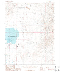
1986 Map of Artesia Lake
USGS Topo · Published 1987About this map
The Singatse Range and Buckskin Range dominate this Nevada landscape, where the intense mining history of Lyon and Douglas Counties is recorded through a dense network of excavations. By the mid-1980s, these mountains were pockmarked with extensive prospects, mine shafts, and significant sites like the Buckskin Mine and Guild-Bovard Mine. Between the peaks lies the broad Smith Valley, home to the ephemeral Artesia Lake and its surrounding State Wildlife Management Area.
Find a feature on this map
24 named features on this map. Tap any name to fly to it.
Don’t see what you’re looking for? This feature index may not catch every label — zoom into the map to look around manually.
Map Details
Editions of this 1986 Artesia Lake Map
This is the sole edition of this map. No revisions or reprints were ever made.
Other maps of this area

1891 · Wabuska
USGS Topo · 1:125,000

1891 · Wellington
USGS Topo · 1:125,000

1893 · Wellington
USGS Topo · 1:125,000

1894 · Wabuska
USGS Topo · 1:125,000

1948 · Walker Lake
USGS Topo · 1:250,000

1957 · Walker Lake
USGS Topo · 1:250,000

1957 · Wellington
USGS Topo · 1:62,500

1957 · Como
USGS Topo · 1:62,500

1957 · Wabuska
USGS Topo · 1:62,500

1957 · Yerington
USGS Topo · 1:62,500