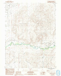
1985 Map of Churchill Butte
USGS Topo · Published 1993About this map
California Emigrant Trail routes converge along the Carson River corridor, illustrating the critical transportation paths that defined this Nevada landscape. The eastern bank of the river is dominated by the Fort Churchill Historic State Monument, where a museum, ruins, and various historical monuments mark the site of the former military post. Nearby, Bucklands Station served as a vital stop for travelers and the Pony Express, anchoring the small settlement at Weeks.
Find a feature on this map
32 named features on this map. Tap any name to fly to it.
Don’t see what you’re looking for? This feature index may not catch every label — zoom into the map to look around manually.
Map Details
Editions of this 1985 Churchill Butte Map
2 editions found
Other maps of this area

1891 · Wabuska
USGS Topo · 1:125,000

1894 · Wabuska
USGS Topo · 1:125,000

1957 · Como
USGS Topo · 1:62,500

1957 · Wabuska
USGS Topo · 1:62,500

1957 · Churchill Butte
USGS Topo · 1:62,500

1957 · Silver Springs
USGS Topo · 1:62,500

1957 · Reno
USGS Topo · 1:250,000

1959 · Reno
USGS Topo · 1:250,000

1960 · Reno
USGS Topo · 1:250,000

1979 · Carson City
USGS Topo · 1:100,000