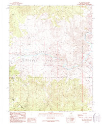
1989 Map of The Elbow
USGS Topo · Published 1989About this map
The East Walker River cuts a deep path through the high desert terrain of the Toiyabe National Forest, defining the geography of this remote corner where Lyon Co and Mineral County meet. The map reveals the quiet presence of small settlements and resource extraction during the late 1980s, centered around The Elbow and Sonoma. A lone Cemetery and various Prospect points suggest a history of early mining activity and small-scale habitation along the river valley.
Find a feature on this map
14 named features on this map. Tap any name to fly to it.
Don’t see what you’re looking for? This feature index may not catch every label — zoom into the map to look around manually.
Map Details
Editions of this 1989 The Elbow Map
This is the sole edition of this map. No revisions or reprints were ever made.
Other maps of this area

1891 · Wellington
USGS Topo · 1:125,000

1893 · Wellington
USGS Topo · 1:125,000

1909 · Hawthorne
USGS Topo · 1:250,000

1909 · Bridgeport
USGS Topo · 1:125,000

1911 · Bridgeport
USGS Topo · 1:125,000

1911 · Hawthorne
USGS Topo · 1:250,000

1915 · Hawthorne
USGS Topo · 1:250,000

1920 · Bridgeport
USGS Topo · 1:125,000

1948 · Walker Lake
USGS Topo · 1:250,000

1956 · Mt. Grant
USGS Topo · 1:62,500