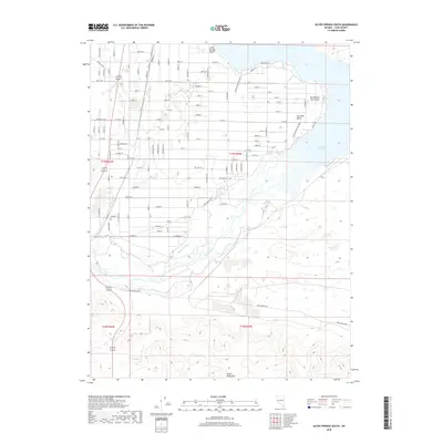
2018 Map of Silver Springs South
USGS Topo · Published 2018About this map
Churchill Valley and the northern slopes of the Desert Mountains anchor this 2018 survey of the Nevada landscape southeast of Silver Springs. The northern portion of the map is defined by the substantial waters of the Lahontan Reservoir, which provides recreation at Silver Springs Beach and the Lahontan State Rec Area. The hydrological system of the Carson River is central to the area's development, evidenced by the Buckland Ditch and the distinctive Big Bend of the Carson.
Find a feature on this map
95 named features on this map. Tap any name to fly to it.
Don’t see what you’re looking for? This feature index may not catch every label — zoom into the map to look around manually.
Map Details
Editions of this 2018 Silver Springs South Map
This is the sole edition of this map. No revisions or reprints were ever made.
Other maps of this area

1891 · Wabuska
USGS Topo · 1:125,000

1894 · Wabuska
USGS Topo · 1:125,000

1957 · Como
USGS Topo · 1:62,500

1957 · Wabuska
USGS Topo · 1:62,500

1957 · Churchill Butte
USGS Topo · 1:62,500

1957 · Silver Springs
USGS Topo · 1:62,500

1957 · Reno
USGS Topo · 1:250,000

1959 · Reno
USGS Topo · 1:250,000

1960 · Reno
USGS Topo · 1:250,000

1979 · Carson City
USGS Topo · 1:100,000