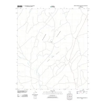
2010 Map of Simpson Springs Mountain
USGS Topo · Published 2010About this map
Simpson Springs Mountain and the surrounding high desert peaks of Brewster County define this landscape at the start of the 21st century. The map centers on the drainage systems of Peña Colorado Creek and Maravillas Creek, which carve through the arid terrain between West Bourland Mountain and East Bourland Mountain. This area is characterized by its vital water sources, including Sunshine Springs, Simpson Springs, and Garden Springs, which have long supported the local cattle ranching economy. The Bourland Ranch stands as a primary landmark in a territory where settlement is sparse and dictated by the proximity to these rare springs. Highway 385 provides the main arterial access through this portion of the Trans-Pecos, connecting these remote landmarks to the broader region of West Texas.
Find a feature on this map
13 named features on this map. Tap any name to fly to it.
Don’t see what you’re looking for? This feature index may not catch every label — zoom into the map to look around manually.
Map Details
Editions of this 2010 Simpson Springs Mountain Map
This is the sole edition of this map. No revisions or reprints were ever made.
Other maps of this area

1917 · Santiago Peak
USGS Topo · 1:62,500

1917 · Hood Spring
USGS Topo · 1:62,500

1918 · Bone Spring
USGS Topo · 1:125,000

1918 · Hood Spring
USGS Topo · 1:62,500

1918 · Santiago Peak
USGS Topo · 1:62,500

1920 · Monument Spring
USGS Topo · 1:62,500

1920 · Marathon
USGS Topo · 1:62,500

1921 · Monument Spring
USGS Topo · 1:62,500

1921 · Marathon
USGS Topo · 1:62,500

1931 · Hood Spring
USGS Topo · 1:62,500