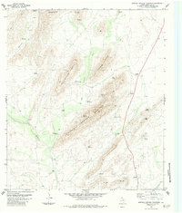
1983 Map of Simpson Springs Mountain
USGS Topo · Published 1984About this map
Simpson Springs Mountain and the surrounding high desert terrain of Brewster County are defined by a complex network of intermittent water sources and ranching infrastructure. This landscape, surveyed in the late 1970s and edited in 1983, centers on the massive forms of West Bourland Mountain and East Bourland Mountain. The importance of water in this arid environment is evident in the numerous named springs and wells, such as Sunshine Springs, Ridge Springs, and Hatch Well.
Find a feature on this map
32 named features on this map. Tap any name to fly to it.
Don’t see what you’re looking for? This feature index may not catch every label — zoom into the map to look around manually.
Map Details
Editions of this 1983 Simpson Springs Mountain Map
This is the sole edition of this map. No revisions or reprints were ever made.
Other maps of this area

1917 · Santiago Peak
USGS Topo · 1:62,500

1917 · Hood Spring
USGS Topo · 1:62,500

1918 · Bone Spring
USGS Topo · 1:125,000

1918 · Hood Spring
USGS Topo · 1:62,500

1918 · Santiago Peak
USGS Topo · 1:62,500

1920 · Monument Spring
USGS Topo · 1:62,500

1920 · Marathon
USGS Topo · 1:62,500

1921 · Monument Spring
USGS Topo · 1:62,500

1921 · Marathon
USGS Topo · 1:62,500

1931 · Hood Spring
USGS Topo · 1:62,500