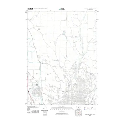
2010 Map of Sioux City North
USGS Topo · Published 2010About this map
Briar Cliff University overlooks the urban-rural interface where Iowa meets South Dakota at the start of the 2010s. The Big Sioux River serves as a prominent natural boundary, separating North Sioux City from the residential neighborhoods of Riverside. This landscape is characterized by a mix of established community institutions and natural features, including Dakota Point and the winding course of West Branch Perry Creek. The map provides significant genealogical value through its marking of burial grounds like the Hancock Township Cemetery in the north and the centrally located Logan Park Cemetery. To the south, the city grid tightens around landmarks such as Memorial Field, while the northern reaches transition into a network of rural roads like 305th St and Broken Kettle Rd, reflecting the regional expansion of suburban developments into traditional agricultural land.
Find a feature on this map
55 named features on this map. Tap any name to fly to it.
Don’t see what you’re looking for? This feature index may not catch every label — zoom into the map to look around manually.
Map Details
Editions of this 2010 Sioux City North Map
This is the sole edition of this map. No revisions or reprints were ever made.
Other maps of this area

1898 · Elk Point
USGS Topo · 1:125,000

1901 · Elk Point
USGS Topo · 1:125,000

1907 · Elk Point
USGS Topo · 1:125,000

1955 · Sioux City
USGS Topo · 1:250,000

1958 · Sioux City
USGS Topo · 1:250,000

1959 · Sioux City
USGS Topo · 1:250,000

1963 · Sioux City South
USGS Topo · 1:24,000

1963 · Sioux City North
USGS Topo · 1:24,000

1963 · Elk Point NE
USGS Topo · 1:24,000

1963 · Jefferson
USGS Topo · 1:24,000