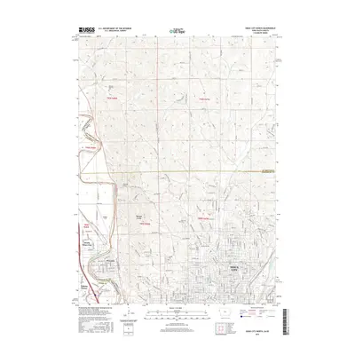
2015 Map of Sioux City North
USGS Topo · Published 2015About this map
The Big Sioux River carves a winding path through this region, serving as the natural boundary between Iowa and South Dakota. This intersection of state lines and county borders includes portions of Woodbury and Union Counties, with Plymouth County situated just to the north. The urban footprint of Sioux City is well-defined, showing the residential and institutional layout as it stood in the mid-2010s. Notable educational landmarks like Briar Cliff Univ and Saint Luke's Coll anchor the city's northern neighborhoods.
Find a feature on this map
225 named features on this map. Tap any name to fly to it.
Don’t see what you’re looking for? This feature index may not catch every label — zoom into the map to look around manually.
Map Details
Editions of this 2015 Sioux City North Map
This is the sole edition of this map. No revisions or reprints were ever made.
Other maps of this area

1898 · Elk Point
USGS Topo · 1:125,000

1901 · Elk Point
USGS Topo · 1:125,000

1907 · Elk Point
USGS Topo · 1:125,000

1955 · Sioux City
USGS Topo · 1:250,000

1958 · Sioux City
USGS Topo · 1:250,000

1959 · Sioux City
USGS Topo · 1:250,000

1963 · Sioux City South
USGS Topo · 1:24,000

1963 · Sioux City North
USGS Topo · 1:24,000

1963 · Elk Point NE
USGS Topo · 1:24,000

1963 · Jefferson
USGS Topo · 1:24,000