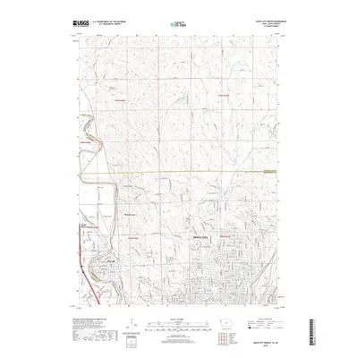
2018 Map of Sioux City North
USGS Topo · Published 2018About this map
The Big Sioux River carves a sharp boundary between Iowa and South Dakota, anchoring a landscape where the urban reach of Sioux City meets the wooded bluffs of Stone State Park. In the northern stretches, the terrain is defined by a dense network of rural roads like 305th St and Co Hwy K19, serving outlying areas such as Millnerville. The mapping reveals a high density of sites essential for genealogical research, including the Hancock Township Cem in the north and Logan Park Cem nestled near the city's edge.
Find a feature on this map
89 named features on this map. Tap any name to fly to it.
Don’t see what you’re looking for? This feature index may not catch every label — zoom into the map to look around manually.
Map Details
Editions of this 2018 Sioux City North Map
This is the sole edition of this map. No revisions or reprints were ever made.
Other maps of this area

1898 · Elk Point
USGS Topo · 1:125,000

1901 · Elk Point
USGS Topo · 1:125,000

1907 · Elk Point
USGS Topo · 1:125,000

1955 · Sioux City
USGS Topo · 1:250,000

1958 · Sioux City
USGS Topo · 1:250,000

1959 · Sioux City
USGS Topo · 1:250,000

1963 · Sioux City South
USGS Topo · 1:24,000

1963 · Sioux City North
USGS Topo · 1:24,000

1963 · Elk Point NE
USGS Topo · 1:24,000

1963 · Jefferson
USGS Topo · 1:24,000