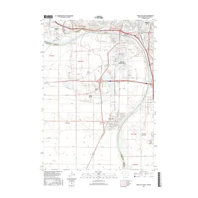
2015 Map of Sioux City South
USGS Topo · Published 2015About this map
The Missouri River and Big Sioux River define this tri-state junction where Iowa, Nebraska, and South Dakota meet. The urban landscape of Sioux City and South Sioux City is mapped in high detail, showing the intricate street grids and the BNSF Railway lines that have long powered the region's industry. To the south, Dakota City remains a distinct settlement near the riverbanks, while the residential development of Dakota Dunes occupies the bend in the Big Sioux. Local heritage is preserved at Saint Michaels Cem and Floyd Cem, while the industrial and transportation hub is anchored by the Sioux Gateway Airport/Col Bud Day Field. Water-based recreation and residential pockets like North Shore and Millis Beach surround Crystal Lake, illustrating how the oxbow lakes of the Missouri floodplain have been integrated into the modern community.
Find a feature on this map
164 named features on this map. Tap any name to fly to it.
Don’t see what you’re looking for? This feature index may not catch every label — zoom into the map to look around manually.
Map Details
Editions of this 2015 Sioux City South Map
This is the sole edition of this map. No revisions or reprints were ever made.
Other maps of this area

1898 · Elk Point
USGS Topo · 1:125,000

1901 · Elk Point
USGS Topo · 1:125,000

1907 · Elk Point
USGS Topo · 1:125,000

1955 · Sioux City
USGS Topo · 1:250,000

1958 · Sioux City
USGS Topo · 1:250,000

1959 · Sioux City
USGS Topo · 1:250,000

1963 · Sioux City South
USGS Topo · 1:24,000

1963 · Sioux City North
USGS Topo · 1:24,000

1963 · Jefferson
USGS Topo · 1:24,000

1964 · Sergeant Bluff
USGS Topo · 1:24,000