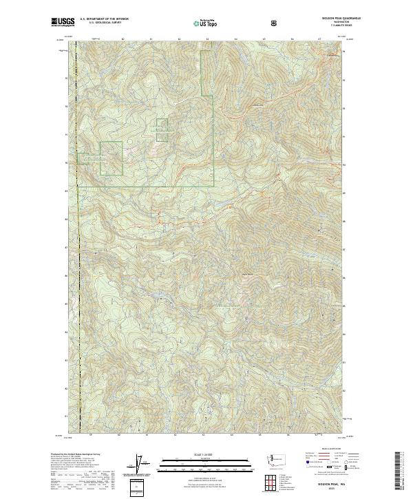
2023 Map of Siouxon Peak
USGS Topo · Published 2023About this map
The Gifford Pinchot National Forest dominates this landscape, defined by a network of steep drainages and high points where the Clark and Skamania county lines meet. The terrain is structured by the deep valley of Siouxon Creek, which is fed by numerous tributaries including North Siouxon Creek, West Creek, and Wildcat Creek. This 2023 survey illustrates a high-elevation backcountry used primarily for recreation and conservation, centered on prominent summits like Siouxon Peak and Huffman Peak.
Find a feature on this map
26 named features on this map. Tap any name to fly to it.
Don’t see what you’re looking for? This feature index may not catch every label — zoom into the map to look around manually.
Map Details
Editions of this 2023 Siouxon Peak Map
This is the sole edition of this map. No revisions or reprints were ever made.
Other maps of this area

1919 · Mount St Helens
USGS Topo · 1:125,000

1940 · Lookout Mtn
USGS Topo · 1:62,500

1941 · Yacolt
USGS Topo · 1:62,500

1948 · Vancouver
USGS Topo · 1:250,000

1950 · Vancouver
USGS Topo · 1:250,000

1950 · Vancouver
USGS Topo · 1:250,000

1953 · Hoquiam
USGS Topo · 1:250,000

1953 · Lookout Mtn
USGS Topo · 1:62,500

1953 · Cougar
USGS Topo · 1:62,500
1956 · Yacolt
USGS Topo · 1:62,500