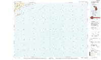
1985 Map of Siskiwit Bay
USGS Topo · Published 1994About this map
Isle Royale National Park dominates the landscape of this 1980s-era topographical record, showing the complex chain of ridges and harbors that define the southern portion of the island in Lake Superior. The terrain is characterized by parallel formations such as Greenstone Ridge and Minong Ridge, which enclose significant interior water bodies like Siskiwit Lake and Lake Desor. These geologic features are crucial for understanding the wilderness character and natural history of the Keweenaw region.
Find a feature on this map
41 named features on this map. Tap any name to fly to it.
Don’t see what you’re looking for? This feature index may not catch every label — zoom into the map to look around manually.
Map Details
Editions of this 1985 Siskiwit Bay Map
2 editions found

Other maps of this area

1895 · Passage Island
USGS Topo · 1:62,500

1938 · Delaware
USGS Topo · 1:31,680

1939 · Delaware
USGS Topo · 1:31,680

1940 · Central
USGS Topo · 1:31,680

1940 · Lake Medora
USGS Topo · 1:31,680

1946 · Phoenix
USGS Topo · 1:24,000

1946 · Eagle Harbor
USGS Topo · 1:24,000

1947 · Phoenix
USGS Topo · 1:24,000
1948 · Eagle Harbor
USGS Topo · 1:24,000
1948 · Delaware
USGS Topo · 1:24,000