
1985 Map of Siskiwit Bay
USGS Topo · Published 1985About this map
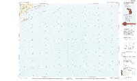
Isle Royale National Park dominates this 1985 survey, showcasing the complex archipelago and ridges of Michigan’s most remote island wilderness. The map details the southern shoreline of the island, where Siskiwit Bay is sheltered by a string of rocky landmasses including Malone Island, Wright Island, and Long Island. The interior geography is defined by prominent elevations like Greenstone Ridge and Minong Ridge, which cradle large inland bodies of water such as Siskiwit Lake and Lake Desor.
Find a feature on this map
52 named features on this map. Tap any name to fly to it.
Don’t see what you’re looking for? This feature index may not catch every label — zoom into the map to look around manually.
Map Details
Editions of this 1985 Siskiwit Bay Map
2 editions found
Other maps of this area

1895 · Passage Island
USGS Topo · 1:62,500

1938 · Delaware
USGS Topo · 1:31,680

1939 · Delaware
USGS Topo · 1:31,680

1940 · Central
USGS Topo · 1:31,680

1940 · Lake Medora
USGS Topo · 1:31,680

1946 · Phoenix
USGS Topo · 1:24,000

1946 · Eagle Harbor
USGS Topo · 1:24,000

1947 · Phoenix
USGS Topo · 1:24,000
1948 · Eagle Harbor
USGS Topo · 1:24,000
1948 · Delaware
USGS Topo · 1:24,000