
1958 Map of Skandia
USGS Topo · Published 1959About this map
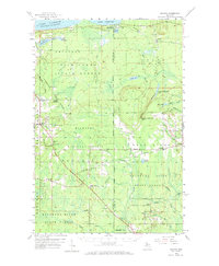
Lake Superior’s southern shoreline defines the northern edge of this survey, where the Duluth South Shore and Atlantic railroad cuts through coastal timberlands. Moving inland, the landscape is heavily influenced by the managed tracts of the Hiawatha National Forest and the Escanaba River State Forest, showing a region defined by forestry and sparse settlement. Local life centers on small communities like Skandia and Deerton, each supported by civic structures such as the Skandia Sch and Emmanuel Ch.
Find a feature on this map
63 named features on this map. Tap any name to fly to it.
Don’t see what you’re looking for? This feature index may not catch every label — zoom into the map to look around manually.
Map Details
Editions of this 1958 Skandia Map
2 editions found
Other maps of this area

1907 · Marquette
USGS Topo · 1:62,500

1932 · Skandia SW
USGS Topo · 1:31,680

1932 · Helena NE
USGS Topo · 1:31,680

1932 · Rock NE
USGS Topo · 1:31,680

1932 · Skandia SE
USGS Topo · 1:31,680

1932 · Skandia NE
USGS Topo · 1:31,680

1932 · Harvey SE
USGS Topo · 1:31,680

1932 · Rock NW
USGS Topo · 1:31,680

1932 · Harvey NE
USGS Topo · 1:31,680

1950 · Skandia NW
USGS Topo · 1:31,680