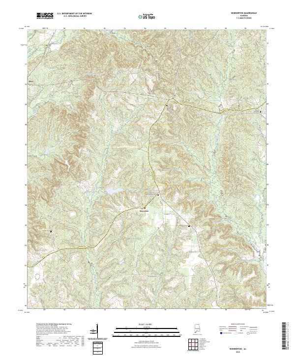
2024 Map of Skinnerton
USGS Topo · Published 2024About this map
Skinnerton and the nearby community of Riley anchor this southern Alabama landscape along the border of Monroe and Conecuh counties. The topography is defined by a dense network of watercourses, including Murder Creek, the West Sepulga River, and Flat Creek, which carve through the wooded terrain. This region is particularly significant for genealogical research, as it contains numerous historic religious and burial sites that serve as the primary landmarks for local families. Landmarks such as Midway Baptist Church Cem, Asbury Methodist Church Cem, and Mount Pleasant Methodist Church Cem are positioned along the county roads. The mapping of House of God Church Keith Dominion Cem and the Lone Star Cem further documents the scattered nature of early settlement patterns in this rural corridor.
Find a feature on this map
43 named features on this map. Tap any name to fly to it.
Don’t see what you’re looking for? This feature index may not catch every label — zoom into the map to look around manually.
Map Details
Editions of this 2024 Skinnerton Map
This is the sole edition of this map. No revisions or reprints were ever made.
Other maps of this area

1953 · Andalusia
USGS Topo · 1:250,000

1957 · Andalusia
USGS Topo · 1:250,000

1967 · Beatrice
USGS Topo · 1:24,000

1971 · Lyeffion
USGS Topo · 1:24,000

1971 · Skinnerton
USGS Topo · 1:24,000

1971 · China
USGS Topo · 1:24,000

1971 · Burnt Corn
USGS Topo · 1:24,000

1971 · Bethel
USGS Topo · 1:24,000

1971 · Beatrice
USGS Topo · 1:24,000
1981 · Nadawah
USGS Topo · 1:24,000