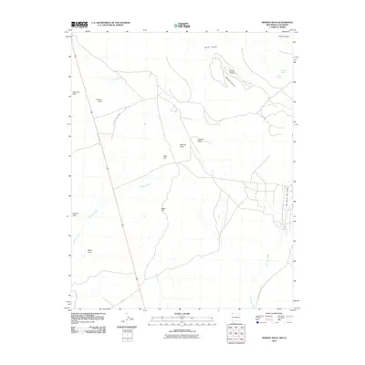
2010 Map of Skinney Rock
USGS Topo · Published 2010About this map
The striking high-desert landscape of northwestern New Mexico is defined by volcanic features and resource extraction in this early 21st-century survey. Notable geological markers such as Volcano Peak, Black Cone, and the namesake Skinney Rock provide fixed points across a terrain carved by Malpais Arroyo and Yellow Arroyo. The presence of the Horseshoe Gallup Oil Field and Weekley Canyon Oil Field underscores the region's industrial significance, showing the infrastructure of energy production interspersed with natural water sources like Pouch Spring and 12R-195 Spring. Access across this arid expanse is managed through the Indian Service Route 5091 and the Big Horse Trail Draw, reflecting the specialized transportation network of the Navajo Nation territory. This map records the intersection of geological antiquity and modern oil and gas development at the turn of the decade.
Find a feature on this map
19 named features on this map. Tap any name to fly to it.
Don’t see what you’re looking for? This feature index may not catch every label — zoom into the map to look around manually.
Map Details
Editions of this 2010 Skinney Rock Map
This is the sole edition of this map. No revisions or reprints were ever made.
Other maps of this area

1889 · Chaco
USGS Topo · 1:250,000

1892 · Chaco
USGS Topo · 1:250,000

1934 · Chimney Rock
USGS Topo · 1:62,500

1934 · Rattlesnake
USGS Topo · 1:62,500

1936 · Chimney Rock
USGS Topo · 1:62,500

1937 · Rattlesnake
USGS Topo · 1:62,500

1954 · Shiprock
USGS Topo · 1:250,000

1956 · Cortez
USGS Topo · 1:250,000

1958 · Cortez
USGS Topo · 1:250,000

1958 · Shiprock
USGS Topo · 1:250,000