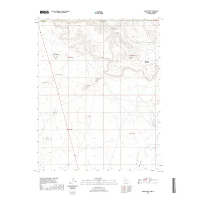
2020 Map of Skinney Rock
USGS Topo · Published 2020About this map
The Colorado and New Mexico state line bisects this high-desert landscape, where the San Juan County and Montezuma County borders meet. This high-plateau geography is defined by prominent landmarks such as Skinney Rock and Flat Top Rock, which serve as permanent navigational waypoints across the arid terrain. The drainage patterns of Tanner Canyon and Weekley Canyon illustrate the erosional forces that have shaped the land, while isolated water sources like Pouch Spring and 12R-195 Spring remain critical features in an otherwise dry environment.
Find a feature on this map
22 named features on this map. Tap any name to fly to it.
Don’t see what you’re looking for? This feature index may not catch every label — zoom into the map to look around manually.
Map Details
Editions of this 2020 Skinney Rock Map
This is the sole edition of this map. No revisions or reprints were ever made.
Other maps of this area

1889 · Chaco
USGS Topo · 1:250,000

1892 · Chaco
USGS Topo · 1:250,000

1934 · Chimney Rock
USGS Topo · 1:62,500

1934 · Rattlesnake
USGS Topo · 1:62,500

1936 · Chimney Rock
USGS Topo · 1:62,500

1937 · Rattlesnake
USGS Topo · 1:62,500

1954 · Shiprock
USGS Topo · 1:250,000

1956 · Cortez
USGS Topo · 1:250,000

1958 · Cortez
USGS Topo · 1:250,000

1958 · Shiprock
USGS Topo · 1:250,000