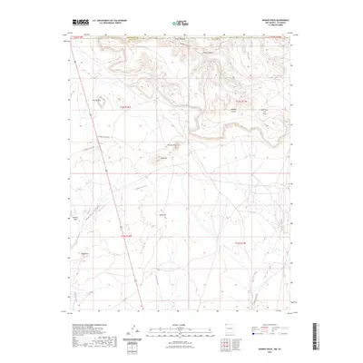
2023 Map of Skinney Rock
USGS Topo · Published 2023About this map
Skinney Rock stands as a prominent landmark in this high-desert landscape where the border between San Juan County and Colorado meets. The terrain is defined by volcanic features and distinct elevations such as Volcano Peak, Black Cone, and the broad plateau of Flat Top Rock. These geological formations are intersected by a network of seasonal watercourses, including Malpais Arroyo and Salt Creek Wash, which drain the arid reaches of the San Juan Basin.
Find a feature on this map
25 named features on this map. Tap any name to fly to it.
Don’t see what you’re looking for? This feature index may not catch every label — zoom into the map to look around manually.
Map Details
Editions of this 2023 Skinney Rock Map
This is the sole edition of this map. No revisions or reprints were ever made.
Other maps of this area

1889 · Chaco
USGS Topo · 1:250,000

1892 · Chaco
USGS Topo · 1:250,000

1934 · Chimney Rock
USGS Topo · 1:62,500

1934 · Rattlesnake
USGS Topo · 1:62,500

1936 · Chimney Rock
USGS Topo · 1:62,500

1937 · Rattlesnake
USGS Topo · 1:62,500

1954 · Shiprock
USGS Topo · 1:250,000

1956 · Cortez
USGS Topo · 1:250,000

1958 · Cortez
USGS Topo · 1:250,000

1958 · Shiprock
USGS Topo · 1:250,000