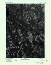
1975 Map of Skowhegan NW
USGS Topo · Published 1980About this map
Athens serves as the central hub of this mid-1970s orthophotoquad, where a cluster of buildings and roads reveals the primary settlement pattern of this Somerset County landscape. The imagery provides a clear look at the agricultural footprint of the era, showing a patchwork of cleared fields and woodlots that surround the main village and the secondary settlement at West Athens. The hydrology of the area is defined by the convergence of the East Branch and the West Branch, which wind through the terrain. Unlike a traditional topographic map, this aerial perspective captures the exact land use and forest density as it existed during the October 1975 flyover, offering a raw record of rural Maine before later twentieth-century development or reforestation altered these field boundaries.
Find a feature on this map
4 named features on this map. Tap any name to fly to it.
Don’t see what you’re looking for? This feature index may not catch every label — zoom into the map to look around manually.
Map Details
Editions of this 1975 Skowhegan NW Map
This is the sole edition of this map. No revisions or reprints were ever made.
Other maps of this area

1903 · Bingham
USGS Topo · 1:62,500

1904 · Anson
USGS Topo · 1:62,500

1905 · Bingham
USGS Topo · 1:62,500

1913 · Skowhegan
USGS Topo · 1:62,500

1948 · Bangor
USGS Topo · 1:250,000

1948 · Kingsbury
USGS Topo · 1:62,500

1950 · Kingsbury
USGS Topo · 1:62,500

1954 · Millinocket
USGS Topo · 1:250,000

1955 · Anson
USGS Topo · 1:62,500

1955 · Skowhegan
USGS Topo · 1:62,500