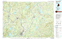
1985 Map of Skowhegan
USGS Topo · Published 1994About this map
The Kennebec River corridor defines this mid-Maine landscape, serving as the historical artery for industrial centers at Waterville, Winslow, and Skowhegan. During the mid-1980s, these river towns remained anchored by the Maine Central Railroad, which traces the water's edge through Fairfield and up toward Madison. Away from the industrial hubs, the map reveals a mosaic of dairy country and timberland, dotted with smaller nineteenth-century settlements like Norridgewock, Clinton, and Pittsfield.
Find a feature on this map
113 named features on this map. Tap any name to fly to it.
Don’t see what you’re looking for? This feature index may not catch every label — zoom into the map to look around manually.
Map Details
Editions of this 1985 Skowhegan Map
2 editions found
Other maps of this area

1892 · Waterville
USGS Topo · 1:62,500

1892 · Augusta
USGS Topo · 1:62,500

1893 · Vassalboro
USGS Topo · 1:62,500

1894 · Norridgewock
USGS Topo · 1:62,500

1898 · Norridgewock
USGS Topo · 1:62,500

1898 · Vassalboro
USGS Topo · 1:62,500

1900 · Bucksport
USGS Topo · 1:62,500

1902 · Bucksport
USGS Topo · 1:62,500

1902 · Bangor
USGS Topo · 1:62,500

1902 · Castine
USGS Topo · 1:62,500