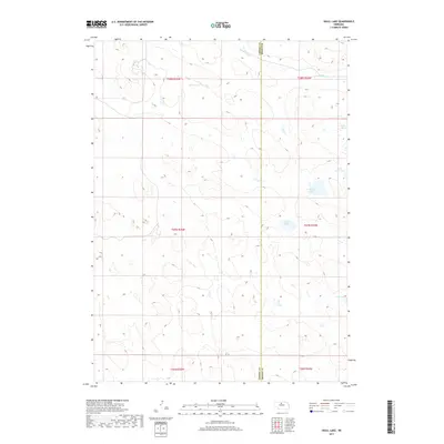
2017 Map of Skull Lake
USGS Topo · Published 2017About this map
The Calamus River meanders through the northern reaches of this landscape on the boundary of Cherry and Brown Counties. This portion of the Nebraska Sandhills is defined by an intricate network of wetlands and namesake basins, including Skull Lake and Rush Lake. The map details the complex hydrography of the region during the early 21st century, revealing how water bodies like Clapper Marsh and North Twin Lake are distributed across the township and range sections. The terrain is largely characterized by these natural depressions and water-storage areas, with few man-made structures or roads, illustrating the remote and preserved nature of this part of the Great Plains. The alignment of Rat Lake in the southeast corner further emphasizes the importance of these isolated water sources in a primarily pastoral and sparsely populated environment.
Find a feature on this map
13 named features on this map. Tap any name to fly to it.
Don’t see what you’re looking for? This feature index may not catch every label — zoom into the map to look around manually.
Map Details
Editions of this 2017 Skull Lake Map
This is the sole edition of this map. No revisions or reprints were ever made.
Other maps of this area

1949 · Purdum
USGS Topo · 1:62,500

1949 · Koshopah
USGS Topo · 1:62,500

1949 · Long Lake
USGS Topo · 1:62,500

1951 · Long Lake
USGS Topo · 1:62,500

1951 · Purdum
USGS Topo · 1:62,500

1951 · Moon Lake
USGS Topo · 1:62,500

1951 · Koshopah
USGS Topo · 1:62,500

1957 · Valentine
USGS Topo · 1:250,000

1959 · Valentine
USGS Topo · 1:250,000

1985 · Wilson Valley
USGS Topo · 1:24,000