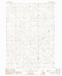
1985 Map of Skull Lake
USGS Topo · Published 1986About this map
Calamus River meanders across the northern reaches of this mid-1980s survey, marking a distinct hydrological boundary in the Sandhills region along the border of Cherry Co and Brown Co. The landscape is defined by a dense network of depressions and isolated basins, characteristic of this Nebraska terrain where water gathers in localized pools and marshes rather than integrated drainage systems. Many of these features bear specific names like Skull Lake, Rush Lake, and Rat Lake, which serve as critical landmarks for local orientation. The presence of numerous irrigation wells near the river indicates the agricultural adaptations of the era, while the eastern portion of the sheet is punctuated by Clapper Marsh and North Twin Lake, illustrating the varied wetland environments that dominate this portion of the Nebraska interior.
Find a feature on this map
7 named features on this map. Tap any name to fly to it.
Don’t see what you’re looking for? This feature index may not catch every label — zoom into the map to look around manually.
Map Details
Editions of this 1985 Skull Lake Map
This is the sole edition of this map. No revisions or reprints were ever made.
Other maps of this area

1949 · Purdum
USGS Topo · 1:62,500

1949 · Koshopah
USGS Topo · 1:62,500

1949 · Long Lake
USGS Topo · 1:62,500

1951 · Long Lake
USGS Topo · 1:62,500

1951 · Purdum
USGS Topo · 1:62,500

1951 · Moon Lake
USGS Topo · 1:62,500

1951 · Koshopah
USGS Topo · 1:62,500

1957 · Valentine
USGS Topo · 1:250,000

1959 · Valentine
USGS Topo · 1:250,000

1985 · Wilson Valley
USGS Topo · 1:24,000