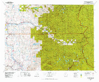
1975 Map of Skykomish River
USGS Topo · Published 1977About this map
The Skykomish River corridor serves as the central artery for this mid-1970s study, tracing the transition from the agricultural lowlands near Monroe and Carnation into the high wilderness of the Glacier Peak Wilderness. This landscape is defined by the three forks of the Snoqualmie River and the industrial footprint of the Burlington Northern railroad. Notable historic sites include the old mining camps at Monte Cristo and Silverton, along with the Old Cascade Tunnel which marks a significant chapter in transcontinental rail history. The map also documents institutional and recreational landmarks, from the State Reformatory near Monroe to the Garland Mineral Springs and the Pacific Crest National Scenic Trail. The varied terrain, moving from the Sultan basin to peaks like Mount Index and Gunn Peak, reflects the dual identity of the region as both a resource-rich timber zone and a protected wilderness area within the Snoqualmie National Forest.
Find a feature on this map
118 named features on this map. Tap any name to fly to it.
Don’t see what you’re looking for? This feature index may not catch every label — zoom into the map to look around manually.
Map Details
Editions of this 1975 Skykomish River Map
2 editions found
Other maps of this area

1895 · Snohomish
USGS Topo · 1:125,000

1897 · Mount Stuart
USGS Topo · 1:125,000

1897 · Tacoma
USGS Topo · 1:125,000

1897 · Seattle
USGS Topo · 1:125,000

1899 · Glacier Peak
USGS Topo · 1:125,000

1899 · Stillaguamish
USGS Topo · 1:125,000

1900 · Tacoma
USGS Topo · 1:125,000

1901 · Glacier Peak
USGS Topo · 1:125,000

1901 · Stilaguamish
USGS Topo · 1:125,000

1901 · Chiwaukum
USGS Topo · 1:125,000